| Introduction - Turkmenistan: |
| Country | Turkmenistan |
|
|
|
| Background | Annexed by Russia between 1865 and 1885, Turkmenistan became a Soviet republic in 1924. It achieved independence upon the dissolution of the USSR in 1991. Extensive hydrocarbon/natural gas reserves could prove a boon to this underdeveloped country if extraction and delivery projects were to be expanded. The Turkmenistan Government is actively seeking to develop alternative petroleum transportation routes to break Russias pipeline monopoly. President for Life Saparmurat NIYAZOV died in December 2006, and Turkmenistan held its first multi-candidate presidential electoral process in February 2007. Gurbanguly BERDIMUHAMEDOW, a former NIYAZOV aide, emerged as the countrys new president. |
|
|
|
| Location - Turkmenistan: |
| Location | Central Asia, bordering the Caspian Sea, between Iran and Kazakhstan |
|
| Geographic coordinates | 40 00 N, 60 00 E |
|
| Map references | Asia |
|
| Area | total: 488,100 sq km
land: 488,100 sq km
water: NEGL |
|
| Area comparative | slightly larger than California |
|
| Land boundaries | total: 3,736 km
border countries: Afghanistan 744 km, Iran 992 km, Kazakhstan 379 km, Uzbekistan 1,621 km |
|
| Coastline | 0 km; note - Turkmenistan borders the Caspian Sea (1,768 km) |
|
| Maritime claims | none (landlocked) |
|
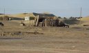
| Climate | subtropical desert |
|
| Terrain | flat-to-rolling sandy desert with dunes rising to mountains in the south; low mountains along border with Iran; borders Caspian Sea in west |
|
| Elevation extremes | lowest point: Vpadina Akchanaya -81 m; note - Sarygamysh Koli is a lake in northern Turkmenistan with a water level that fluctuates above and below the elevation of Vpadina Akchanaya (the lake has dropped as low as -110 m)
highest point: Gora Ayribaba 3,139 m |
|
| Natural resources | petroleum, natural gas, sulfur, salt |
|
| Land use | arable land: 4.51%
permanent crops: 0.14%
other: 95.35% (2005) |
|
| Irrigated land | 18,000 sq km (2003) |
|
| Natural hazards | NA |
|
| Environment current issues | contamination of soil and groundwater with agricultural chemicals, pesticides; salination, water logging of soil due to poor irrigation methods; Caspian Sea pollution; diversion of a large share of the flow of the Amu Darya into irrigation contributes to that rivers inability to replenish the Aral Sea; desertification |
|
| Environment international agreements | party to: Biodiversity, Climate Change, Climate Change-Kyoto Protocol, Desertification, Hazardous Wastes, Ozone Layer Protection
signed, but not ratified: none of the selected agreements |
|
| Geography note | landlocked; the western and central low-lying desolate portions of the country make up the great Garagum (Kara-Kum) desert, which occupies over 80% of the country; eastern part is plateau |
|
| People - Turkmenistan: |
| Population | 5,097,028 (July 2007 est.) |
|
| Age structure | 0-14 years: 34.7% (male 900,718/female 866,930)
15-64 years: 60.9% (male 1,537,638/female 1,567,049)
65 years and over: 4.4% (male 97,454/female 127,239) (2007 est.) |
|
| Median age | total: 22.3 years
male: 21.7 years
female: 22.9 years (2007 est.) |
|
| Population growth rate | 1.617% (2007 est.) |
|
| Birth rate | 25.36 births/1,000 population (2007 est.) |
|
| Death rate | 6.17 deaths/1,000 population (2007 est.) |
|
| Net migration rate | -3.01 migrant(s)/1,000 population (2007 est.) |
|
| Sex ratio | at birth: 1.05 male(s)/female
under 15 years: 1.039 male(s)/female
15-64 years: 0.981 male(s)/female
65 years and over: 0.766 male(s)/female
total population: 0.99 male(s)/female (2007 est.) |
|
| Infant mortality rate | total: 53.49 deaths/1,000 live births
male: 57.84 deaths/1,000 live births
female: 48.91 deaths/1,000 live births (2007 est.) |
|
| Life expectancy at birth | total population: 68.3 years
male: 65.23 years
female: 71.54 years (2007 est.) |
|
| Total fertility rate | 3.13 children born/woman (2007 est.) |
|
| Hiv aids adult prevalence rate | less than 0.1% (2004 est.) |
|
| Hiv aids people living with hiv aids | less than 200 (2003 est.) |
|
| Hiv aids deaths | less than 100 (2004 est.) |
|
| Nationality | noun: Turkmen(s)
adjective: Turkmenistani |
|
| Ethnic groups | Turkmen 85%, Uzbek 5%, Russian 4%, other 6% (2003) |
|
| Religions | Muslim 89%, Eastern Orthodox 9%, unknown 2% |
|
| Languages | Turkmen 72%, Russian 12%, Uzbek 9%, other 7% |
|
| Literacy | definition: age 15 and over can read and write
total population: 98.8%
male: 99.3%
female: 98.3% (1999 est.) |
|
| Government - Turkmenistan: |
| Country name | conventional long form: none
conventional short form: Turkmenistan
local long form: none
local short form: Turkmenistan
former: Turkmen Soviet Socialist Republic |
|
| Government type | republic; authoritarian presidential rule, with little power outside the executive branch |
|
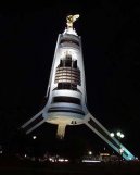
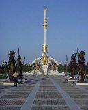
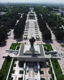
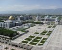
| Capital | name: Ashgabat (Ashkhabad)
geographic coordinates: 37 57 N, 58 23 E
time difference: UTC+5 (10 hours ahead of Washington, DC during Standard Time) |
|
| Administrative divisions | 5 provinces (welayatlar, singular - welayat) and 1 independent city*: Ahal Welayaty (Anew), Ashgabat*, Balkan Welayaty (Balkanabat), Dashoguz Welayaty, Lebap Welayaty (Turkmenabat), Mary Welayaty
note: administrative divisions have the same names as their administrative centers (exceptions have the administrative center name following in parentheses) |
|
| Independence | 27 October 1991 (from the Soviet Union) |
|
| National holiday | Independence Day, 27 October (1991) |
|
| Constitution | adopted 18 May 1992 |
|
| Legal system | based on civil law system and Islamic law; has not accepted compulsory ICJ jurisdiction |
|
| Suffrage | 18 years of age; universal |
|
| Executive branch | chief of state: President Gurbanguly BERDIMUHAMEDOW (since 14 February 2007); note - the president is both the chief of state and head of government
head of government: President Gurbanguly BERDIMUHAMEDOW (since 14 February 2007)
cabinet: Cabinet of Ministers appointed by the president
elections: president elected by popular vote for a five-year term; election last held on 11 February 2007 (next to be held in 2012)
election results: Gurbanguly BERDIMUHAMEDOW elected president; percent of vote - Gurbanguly BERDIMUHAMEDOW 89.2% |
|
| Legislative branch | two parliamentary bodies, a Peoples Council or Halk Maslahaty (supreme legislative body of up to 2,500 delegates, some elected by popular vote and some appointed; meets at least yearly) and a National Assembly or Mejlis (50 seats; members are elected by popular vote to serve five-year terms)
elections: Peoples Council - last held in April 2003 (next to be held in December 2008); Mejlis - last held 19 December 2004 (next to be held in December 2008)
election results: Mejlis - DPT 100%; seats by party - DPT 50; note - all 50 elected officials are members of the Democratic Party of Turkmenistan and are preapproved by the president
note: in late 2003, a law was adopted reducing the powers of the Mejlis and making the Halk Maslahaty the supreme legislative organ; the Halk Maslahaty can now legally dissolve the Mejlis, and the president is now able to participate in the Mejlis as its supreme leader; the Mejlis can no longer adopt or amend the constitution or announce referendums or its elections; since the president is both the Chairman for Life of the Halk Maslahaty and the supreme leader of the Mejlis, the 2003 law has the effect of making him the sole authority of both the executive and legislative branches of government |
|
| Judicial branch | Supreme Court (judges are appointed by the president) |
|
| Political parties and leaders | Democratic Party of Turkmenistan or DPT
note: formal opposition parties are outlawed; unofficial, small opposition movements exist underground or in foreign countries; the two most prominent opposition groups-in-exile have been National Democratic Movement of Turkmenistan (NDMT) and the United Democratic Party of Turkmenistan (UDPT); NDMT was led by former Foreign Minister Boris SHIKHMURADOV until his arrest and imprisonment in the wake of the 25 November 2002 assassination attempt on President NIYAZOV; UDPT is led by former Foreign Minister Abdy KULIEV and is based in Moscow |
|
| Political pressure groups and leaders | NA |
|
| International organization participation | AsDB, CIS, EAPC, EBRD, ECO, FAO, G-77, IBRD, ICAO, ICRM, IDB, IFC, IFRCS, ILO, IMF, IMO, Interpol, IOC, IOM (observer), ISO (correspondent), ITU, MIGA, NAM, OIC, OPCW, OSCE, PFP, UN, UNCTAD, UNESCO, UNIDO, UNWTO, UPU, WCO, WFTU, WHO, WIPO, WMO |
|
| Diplomatic representation in the us | chief of mission: Ambassador Meret Bairamovich ORAZOW
chancery: 2207 Massachusetts Avenue NW, Washington, DC 20008
telephone: [1] (202) 588-1500
FAX: [1] (202) 588-0697 |
|
| Diplomatic representation from the us | chief of mission: Ambassador (vacant); Charge dAffaires Jennifer L. BRUSH
embassy: No. 9 1984 Street (formerly Pushkin Street), Ashgabat, Turkmenistan 774000
mailing address: 7070 Ashgabat Place, Washington, DC 20521-7070
telephone: [993] (12) 35-00-45
FAX: [993] (12) 39-26-14 |
|
| Flag description | green field with a vertical red stripe near the hoist side, containing five tribal guls (designs used in producing carpets) stacked above two crossed olive branches similar to the olive branches on the UN flag; a white crescent moon representing Islam with five white stars representing the regions or velayats of Turkmenistan appear in the upper corner of the field just to the fly side of the red stripe |
|
| Economy - Turkmenistan: |
| Economy overview | Turkmenistan is a largely desert country with intensive agriculture in irrigated oases and large gas and oil resources. One-half of its irrigated land is planted in cotton; formerly it was the worlds 10th-largest producer. Poor harvests in recent years have led to an almost 50% decline in cotton exports. With an authoritarian ex-Communist regime in power and a tribally based social structure, Turkmenistan has taken a cautious approach to economic reform, hoping to use gas and cotton sales to sustain its inefficient economy. Privatization goals remain limited. From 1998-2005, Turkmenistan suffered from the continued lack of adequate export routes for natural gas and from obligations on extensive short-term external debt. At the same time, however, total exports rose by an average of 15% per year from 2003-06, largely because of higher international oil and gas prices. In 2006, Ashgabat raised its natural gas export prices to its main customer, Russia, from $66 per thousand cubic meters (tcm) to $100 per tcm. Overall prospects in the near future are discouraging because of widespread internal poverty, a poor educational system, government misuse of oil and gas revenues, and Ashgabats unwillingness to adopt market-oriented reforms. Turkmenistans economic statistics are state secrets, and GDP and other figures are subject to wide margins of error. In particular, the rate of GDP growth is uncertain. President BERDIMUHAMEDOWs election platform included plans to build a gas line to China, to complete the AmuDarya railroad bridge in Lebap province, and to create special border trade zones in southern Balkan province - a hint that the new post-NIYAZOV government will work to create a friendlier foreign investment environment. |
|
| Gdp purchasing power parity | $42.84 billion (2006 est.) |
|
| Gdp official exchange rate | $15.18 billion (2006 est.) |
|
| Gdp real growth rate | IMF estimate: 6%
note: official government statistics show 21.4% growth, but these estimates are widely regarded as unreliable (2006 est.) |
|
| Gdp per capita ppp | $8,500 (2006 est.) |
|
| Gdp composition by sector | agriculture: 24.4%
industry: 33.9%
services: 41.7% (2006 est.) |
|
| Labor force | 2.32 million (2003 est.) |
|
| Labor force by occupation | agriculture: 48.2%
industry: 13.8%
services: 37% (2003 est.) |
|
| Unemployment rate | 60% (2004 est.) |
|
| Population below poverty line | 58% (2003 est.) |
|
| Household income or consumption by percentage share | lowest 10%: 2.6%
highest 10%: 31.7% (1998) |
|
| Distribution of family income gini index | 40.8 (1998) |
|
| Inflation rate consumer prices | 11% (2006 est.) |
|
| Investment gross fixed | 28.8% of GDP (2006 est.) |
|
| Budget | revenues: $1.803 billion
expenditures: $2.063 billion; including capital expenditures of $NA (2006 est.) |
|
| Agriculture products | cotton, grain; livestock |
|
| Industries | natural gas, oil, petroleum products, textiles, food processing |
|
| Industrial production growth rate | 22% (2003 est.) |
|
| Electricity production | 10.79 billion kWh (2004 est.) |
|
| Electricity consumption | 9.03 billion kWh (2004) |
|
| Electricity exports | 1 billion kWh (2004) |
|
| Electricity imports | 0 kWh (2004) |
|
| Oil production | 213,700 bbl/day (2004 est.) |
|
| Oil consumption | 95,000 bbl/day (2004 est.) |
|
| Oil exports | 117,800 bbl/day (2004 est.) |
|
| Oil imports | NA bbl/day |
|
| Oil proved reserves | 546 million bbl (1 January 2005 est.) |
|
| Natural gas production | 58.57 billion cu m (2004 est.) |
|
| Natural gas consumption | 16.57 billion cu m (2004 est.) |
|
| Natural gas exports | 42 billion cu m (2004 est.) |
|
| Natural gas imports | 0 cu m (2004 est.) |
|
| Natural gas proved reserves | 2.01 trillion cu m (1 January 2005 est.) |
|
| Current account balance | $321.2 million (2006 est.) |
|
| Exports | $5.421 billion f.o.b. (2006 est.) |
|
| Exports commodities | gas, crude oil, petrochemicals, cotton fiber, textiles |
|
| Exports partners | Ukraine 47.1%, Iran 16.2%, Azerbaijan 4.3% (2006) |
|
| Imports | $3.936 billion f.o.b. (2006 est.) |
|
| Imports commodities | machinery and equipment, chemicals, foodstuffs |
|
| Imports partners | UAE 13.6%, Azerbaijan 11.8%, Turkey 9.8%, Ukraine 8%, Russia 8%, Germany 6.8%, Iran 6.7%, China 5.6% (2006) |
|
| Reserves of foreign exchange and gold | $3.518 billion (2006 est.) |
|
| Debt external | $2.4 billion to $5 billion (2001 est.) |
|
| Economic aid recipient | $16 million from the US (2001) |
|
| Currency code | Turkmen manat (TMM) |
|
| Exchange rates | Turkmen manat per US$ - 11,100 (2006) official rate
note: in recent years the unofficial rate has hovered around 24,000 to 25,000 Turkmen manats to the dollar |
|
| Communications - Turkmenistan: |
| Fiscal year | calendar year |
|
| Telephones main lines in use | 495,000 (2006) |
|
| Telephones mobile cellular | 105,000 (2005) |
|
| Telephone system | general assessment: poorly developed
domestic: Turkmenistans telecommunications network remains woefully underdeveloped; Turkmentelekom, in cooperation with foreign investors, is planning to upgrade the countrys telephone exchanges and install a new digital switching system
international: country code - 993; linked by cable and microwave radio relay to other CIS republics and to other countries by leased connections to the Moscow international gateway switch; a new telephone link from Ashgabat to Iran has been established; a new exchange in Ashgabat switches international traffic through Turkey via Intelsat; satellite earth stations - 1 Orbita and 1 Intelsat (2006) |
|
| Radio broadcast stations | AM 16, FM 8, shortwave 2 (1998) |
|
| Television broadcast stations | 4 (government-owned and programmed) (2004) |
|
| Internet country code | .tm |
|
| Internet hosts | 585 (2006) |
|
| Internet users | 64,800 (2006) |
|
| Transportation - Turkmenistan: |
| Airports | 29 (2006) |
|
| Airports with paved runways | total: 22
over 3,047 m: 1
2,438 to 3,047 m: 11
1,524 to 2,437 m: 8
914 to 1,523 m: 2 (2006) |
|
| Airports with unpaved runways | total: 7
1,524 to 2,437 m: 2
914 to 1,523 m: 1
under 914 m: 4 (2006) |
|
| Heliports | 1 (2006) |
|
| Pipelines | gas 6,441 km; oil 1,361 km (2006) |
|
| Railways | total: 2,440 km
broad gauge: 2,440 km 1.520-m gauge (2006) |
|
| Roadways | total: 24,000 km
paved: 19,488 km
unpaved: 4,512 km (1999) |
|
| Waterways | 1,300 km (Amu Darya and Kara Kum canal important inland waterways) (2006) |
|
| Merchant marine | total: 8 ships (1000 GRT or over) 22,870 GRT/25,801 DWT
by type: cargo 4, combination ore/oil 1, petroleum tanker 2, refrigerated cargo 1 (2006) |
|
| Ports and terminals | Turkmenbasy |
|
| Military - Turkmenistan: |
| Military branches | Ground Forces, Artillery and Rocket Forces, Navy, Air and Air Defense Forces (2006) |
|
| Military service age and obligation | 18-30 years of age for compulsory military service; 2-year conscript service obligation (2006) |
|
| Manpower available for military service | males age 18-49: 1,132,833
females age 18-49: 1,162,569 (2005 est.) |
|
| Manpower fit for military service | males age 18-49: 759,978
females age 18-49: 940,179 (2005 est.) |
|
| Manpower reaching military service age annually | males age 18-49: 56,532
females age 18-49: 55,413 (2005 est.) |
|
| Refugees and internally displaced persons | refugees (country of origin): 11,173 (Tajikistan) (2006) |
|
| Military expenditures percent of gdp | 3.4% (2005 est.) |
|
| Disputes international | cotton monoculture in Uzbekistan and Turkmenistan creates water-sharing difficulties for Amu Darya river states; field demarcation of the boundaries with Kazakhstan commenced in 2005, but Caspian seabed delimitation remains stalled with Azerbaijan, Iran, and Kazakhstan due to Turkmenistans indecision over how to allocate the seas waters and seabed |
|
This page was last updated on 16 September, 2007