| Introduction - Senegal: |
| Country | Senegal |
|
|
|
| Background | The French colonies of Senegal and the French Sudan were merged in 1959 and granted their independence as the Mali Federation in 1960. The union broke up after only a few months. Senegal was ruled by the Socialist Party for 40 years until current President Abdoulaye WADE was elected in 2000. Senegal joined with The Gambia to form the nominal confederation of Senegambia in 1982, but the envisaged integration of the two countries was never carried out, and the union was dissolved in 1989. The most significant threat within Senegal since the 1980s has been led by the Movement of Democratic Forces in the Casamance (MFDC). Although a peace agreement was signed in December 2004, internal rifts continue to keep the peace process deadlocked. Nevertheless, Senegal remains one of the most stable democracies in Africa. Senegal has a long history of participating in international peacekeeping. |
|
|
|
| Location - Senegal: |
| Location | Western Africa, bordering the North Atlantic Ocean, between Guinea-Bissau and Mauritania |
|
| Geographic coordinates | 14 00 N, 14 00 W |
|
| Map references | Africa |
|
| Area | total: 196,190 sq km
land: 192,000 sq km
water: 4,190 sq km |
|
| Area comparative | slightly smaller than South Dakota |
|
| Land boundaries | total: 2,640 km
border countries: The Gambia 740 km, Guinea 330 km, Guinea-Bissau 338 km, Mali 419 km, Mauritania 813 km |
|
| Coastline | 531 km |
|
| Maritime claims | territorial sea: 12 nm
contiguous zone: 24 nm
exclusive economic zone: 200 nm
continental shelf: 200 nm or to the edge of the continental margin |
|
| Climate | tropical; hot, humid; rainy season (May to November) has strong southeast winds; dry season (December to April) dominated by hot, dry, harmattan wind |
|
| Terrain | generally low, rolling, plains rising to foothills in southeast |
|
| Elevation extremes | lowest point: Atlantic Ocean 0 m
highest point: unnamed feature near Nepen Diakha 581 m |
|
| Natural resources | fish, phosphates, iron ore |
|
| Land use | arable land: 12.51%
permanent crops: 0.24%
other: 87.25% (2005) |
|
| Irrigated land | 1,200 sq km (2003) |
|
| Natural hazards | lowlands seasonally flooded; periodic droughts |
|
| Environment current issues | wildlife populations threatened by poaching; deforestation; overgrazing; soil erosion; desertification; overfishing |
|
| Environment international agreements | party to: Biodiversity, Climate Change, Climate Change-Kyoto Protocol, Desertification, Endangered Species, Hazardous Wastes, Law of the Sea, Marine Life Conservation, Ozone Layer Protection, Ship Pollution, Wetlands, Whaling |
|
| Geography note | westernmost country on the African continent; The Gambia is almost an enclave within Senegal |
|
| People - Senegal: |
| Population | 12,521,851 (July 2007 est.) |
|
| Age structure | 0-14 years: 42% (male 2,656,122/female 2,608,423)
15-64 years: 55% (male 3,426,504/female 3,454,372)
65 years and over: 3% (male 176,877/female 199,553) (2007 est.) |
|
| Median age | total: 18.7 years
male: 18.5 years
female: 18.9 years (2007 est.) |
|
| Population growth rate | 2.645% (2007 est.) |
|
| Birth rate | 37.4 births/1,000 population (2007 est.) |
|
| Death rate | 10.96 deaths/1,000 population (2007 est.) |
|
| Net migration rate | 0 migrant(s)/1,000 population (2007 est.) |
|
| Sex ratio | at birth: 1.03 male(s)/female
under 15 years: 1.018 male(s)/female
15-64 years: 0.992 male(s)/female
65 years and over: 0.886 male(s)/female
total population: 1 male(s)/female (2007 est.) |
|
| Infant mortality rate | total: 60.15 deaths/1,000 live births
male: 64.06 deaths/1,000 live births
female: 56.12 deaths/1,000 live births (2007 est.) |
|
| Life expectancy at birth | total population: 56.69 years
male: 55.34 years
female: 58.09 years (2007 est.) |
|
| Total fertility rate | 5 children born/woman (2007 est.) |
|
| Hiv aids adult prevalence rate | 0.8% (2003 est.) |
|
| Hiv aids people living with hiv aids | 44,000 (2003 est.) |
|
| Hiv aids deaths | 3,500 (2003 est.) |
|
| Nationality | noun: Senegalese (singular and plural)
adjective: Senegalese |
|
| Major infectious diseases | degree of risk: very high
food or waterborne diseases: bacterial and protozoal diarrhea, hepatitis A, and typhoid fever
vectorborne diseases: dengue fever, malaria, yellow fever, Crimean-Congo hemorrhagic fever, and Rift Valley fever are high risks in some locations
water contact disease: schistosomiasis
respiratory disease: meningococcal meningitis (2007) |
|
| Ethnic groups | Wolof 43.3%, Pular 23.8%, Serer 14.7%, Jola 3.7%, Mandinka 3%, Soninke 1.1%, European and Lebanese 1%, other 9.4% |
|
| Religions | Muslim 94%, Christian 5% (mostly Roman Catholic), indigenous beliefs 1% |
|
| Languages | French (official), Wolof, Pulaar, Jola, Mandinka |
|
| Literacy | definition: age 15 and over can read and write
total population: 39.3%
male: 51.1%
female: 29.2% (2002 est.) |
|
| Government - Senegal: |
| Country name | conventional long form: Republic of Senegal
conventional short form: Senegal
local long form: Republique du Senegal
local short form: Senegal
former: Senegambia (along with The Gambia); Mali Federation |
|
| Government type | republic |
|
| Capital | name: Dakar
geographic coordinates: 14 40 N, 17 26 W
time difference: UTC 0 (5 hours ahead of Washington, DC during Standard Time) |
|
| Administrative divisions | 11 regions (regions, singular - region); Dakar, Diourbel, Fatick, Kaolack, Kolda, Louga, Matam, Saint-Louis, Tambacounda, Thies, Ziguinchor |
|
| Independence | 4 April 1960 (from France); note - complete independence achieved upon dissolution of federation with Mali on 20 August 1960 |
|
| National holiday | Independence Day, 4 April (1960) |
|
| Constitution | adopted 7 January 2001 |
|
| Legal system | based on French civil law system; judicial review of legislative acts in Constitutional Court; the Council of State audits the governments accounting office; accepts compulsory ICJ jurisdiction with reservations |
|
| Suffrage | 18 years of age; universal |
|
| Executive branch | chief of state: President Abdoulaye WADE (since 1 April 2000)
head of government: Prime Minister Cheikh Hadjibou SOUMARE (since 19 June 2007)
cabinet: Council of Ministers appointed by the prime minister in consultation with the president
elections: president elected by popular vote for a five-year term (eligible for a second term) under new constitution; election last held on 25 February 2007 (next to be held in 2012); prime minister appointed by the president
election results: Abdoulaye WADE reelected president in the first round of voting; percent of vote - Abdoulaye WADE 55.9%, Idrissa SECK 14.9%, Ousmane Tanor DIENG 13.6%, Moustapha NIASSE 5.9%, other 9.7% |
|
| Legislative branch | unicameral National Assembly or Assemblee Nationale (150 seats; 90 members elected by direct popular vote with the remaining members elected by proportional representation from party lists to serve five-year terms)
elections: last held on 3 June 2007 (next to be held 2012); note - the National Assembly in December 2005 voted to postpone legislative elections originally scheduled for 2006; legislative elections were first rescheduled to coincide with the 25 February 2007 presidential elections and later rescheduled for 3 June 2007; the June election was marred by the boycott of 12 opposition parties, including the former ruling Socialist Party, that resulted in a drop in voter turnout to a record low 35 percent
election results: percent of vote by party - NA; seats by party - SOPI Coalition 131, other 19 |
|
| Judicial branch | Constitutional Court; Council of State; Court of Final Appeals or Cour de Cassation; Court of Appeals |
|
| Political parties and leaders | African Party of Independence [Majhemout DIOP]; And-Jef/African Party for Democracy and Socialism or AJ/PADS) [Landing SAVANE]; Alliance of Forces of Progress or AFP [Moustapha NIASSE]; Democratic and Patriotic Convention or CDP (also known as Garab-Gi) [Dr. Iba Der THIAM]; Democratic League-Labor Party Movement or LD-MPT [Dr. Abdoulaye BATHILY]; Front for Socialism and Democracy or FSD [Cheikh Abdoulaye Bamba DIEYE]; Gainde Centrist Bloc or BGC [Jean-Paul DIAS]; Independence and Labor Party or PIT [Amath DANSOKHO]; Jef-Jel [Talla SYLLA]; National Democratic Rally or RND [Madior DIOUF]; Peoples Labor Party or PTP [Elhadji DIOUF]; Reform Party or PR [Abdourahim AGNE]; Rewmi [Idrissa SECK]; Senegalese Democratic Party or PDS [Abdoulaye WADE]; Socialist Party or PS [Ousmane Tanor DIENG]; SOPI Coalition [Abdoulaye WADE] (a coalition led by the PDS); Union for Democratic Renewal or URD [Djibo Leyti KA] |
|
| Political pressure groups and leaders | labor; Sufi and Mouride brotherhoods; students; teachers |
|
| International organization participation | ACCT, ACP, AfDB, AU, ECOWAS, FAO, FZ, G-15, G-77, IAEA, IBRD, ICAO, ICC, ICCt, ICRM, IDA, IDB, IFAD, IFC, IFRCS, ILO, IMF, IMO, IMSO, Interpol, IOC, IOM, IPU, ISO (correspondent), ITSO, ITU, ITUC, MIGA, MONUC, NAM, OIC, OIF, ONUB, OPCW, PCA, UN, UNCTAD, UNESCO, UNIDO, Union Latina, UNMIL, UNMOVIC, UNOCI, UNWTO, UPU, WADB (regional), WAEMU, WCL, WCO, WFTU, WHO, WIPO, WMO, WTO |
|
| Diplomatic representation in the us | chief of mission: Ambassador Amadou Lamine BA
chancery: 2112 Wyoming Avenue NW, Washington, DC 20008
telephone: [1] (202) 234-0540
FAX: [1] (202) 332-6315
consulate(s) general: Houston, New York |
|
| Diplomatic representation from the us | chief of mission: Ambassador Janice L. JACOBS
embassy: Avenue Jean XXIII at the corner of Rue Kleber, Dakar
mailing address: B. P. 49, Dakar
telephone: [221] 823-4296
FAX: [221] 822-2991 |
|
| Flag description | three equal vertical bands of green (hoist side), yellow, and red with a small green five-pointed star centered in the yellow band; uses the popular pan-African colors of Ethiopia |
|
| Economy - Senegal: |
| Economy overview | In January 1994, Senegal undertook a bold and ambitious economic reform program with the support of the international donor community. This reform began with a 50% devaluation of Senegals currency, the CFA franc, which was linked at a fixed rate to the French franc. Government price controls and subsidies have been steadily dismantled. After seeing its economy contract by 2.1% in 1993, Senegal made an important turnaround, thanks to the reform program, with real growth in GDP averaging over 5% annually during 1995-2006. Annual inflation had been pushed down to the low single digits. As a member of the West African Economic and Monetary Union (WAEMU), Senegal is working toward greater regional integration with a unified external tariff and a more stable monetary policy. High unemployment, however, continues to prompt illegal migrants to flee Senegal in search of better job opportunities in Europe. Senegal was also beset by an energy crisis that caused widespread blackouts in 2006. Senegal still relies heavily upon outside donor assistance. Under the IMFs Highly Indebted Poor Countries (HIPC) debt relief program, Senegal will benefit from eradication of two-thirds of its bilateral, multilateral, and private-sector debt. |
|
| Gdp purchasing power parity | $21.54 billion (2006 est.) |
|
| Gdp official exchange rate | $8.331 billion (2006 est.) |
|
| Gdp real growth rate | 2% (2006 est.) |
|
| Gdp per capita ppp | $1,800 (2006 est.) |
|
| Gdp composition by sector | agriculture: 18.3%
industry: 19.2%
services: 62.5% (2006 est.) |
|
| Labor force | 4.749 million (2006 est.) |
|
| Labor force by occupation | agriculture: 77%
industry and services: 23% (1990 est.) |
|
| Unemployment rate | 48%; note - urban youth 40% (2001 est.) |
|
| Population below poverty line | 54% (2001 est.) |
|
| Household income or consumption by percentage share | lowest 10%: 2.6%
highest 10%: 33.5% (1995) |
|
| Distribution of family income gini index | 41.3 (1995) |
|
| Inflation rate consumer prices | 2% (2006 est.) |
|
| Investment gross fixed | 41% of GDP (2006 est.) |
|
| Budget | revenues: $2.023 billion
expenditures: $2.377 billion; including capital expenditures of $357 million (2006 est.) |
|
| Public debt | 17.8% of GDP (2006 est.) |
|
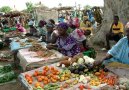
| Agriculture products | peanuts, millet, corn, sorghum, rice, cotton, tomatoes, green vegetables; cattle, poultry, pigs; fish |
|
| Industries | agricultural and fish processing, phosphate mining, fertilizer production, petroleum refining, construction materials, ship construction and repair |
|
| Industrial production growth rate | 3.2% (2006 est.) |
|
| Electricity production | 1.453 billion kWh (2004) |
|
| Electricity consumption | 1.351 billion kWh (2004) |
|
| Electricity exports | 0 kWh (2004) |
|
| Electricity imports | 0 kWh (2004) |
|
| Oil production | 0 bbl/day (2004 est.) |
|
| Oil consumption | 31,000 bbl/day (2004 est.) |
|
| Oil exports | NA bbl/day |
|
| Oil imports | NA bbl/day |
|
| Oil proved reserves | 0 bbl |
|
| Natural gas production | 50 million cu m (2004 est.) |
|
| Natural gas consumption | 50 million cu m (2004 est.) |
|
| Natural gas exports | 0 cu m (2004 est.) |
|
| Natural gas imports | 0 cu m (2004 est.) |
|
| Current account balance | -$895.2 million (2006 est.) |
|
| Exports | $1.478 billion f.o.b. (2006 est.) |
|
| Exports commodities | fish, groundnuts (peanuts), petroleum products, phosphates, cotton |
|
| Exports partners | Mali 18.5%, India 14.3%, France 6.9%, Italy 5.1%, Gambia, The 5% (2006) |
|
| Imports | $2.98 billion f.o.b. (2006 est.) |
|
| Imports commodities | food and beverages, capital goods, fuels |
|
| Imports partners | France 21.3%, Nigeria 10.6%, UK 8.9%, Netherlands 4.9%, China 4.8%, Brazil 4.1% (2006) |
|
| Reserves of foreign exchange and gold | $1.18 billion (2006 est.) |
|
| Debt external | $1.628 billion (2006 est.) |
|
| Economic aid recipient | $449.6 million (2003 est.) |
|
| Currency code | Communaute Financiere Africaine franc (XOF); note - responsible authority is the Central Bank of the West African States |
|
| Exchange rates | Communaute Financiere Africaine francs (XOF) per US dollar - 522.89 (2006), 527.47 (2005), 528.29 (2004), 581.2 (2003), 696.99 (2002) |
|
| Communications - Senegal: |
| Fiscal year | calendar year |
|
| Telephones main lines in use | 282,600 (2006) |
|
| Telephones mobile cellular | 2.983 million (2006) |
|
| Telephone system | general assessment: good system
domestic: above-average urban system; microwave radio relay, coaxial cable and fiber-optic cable in trunk system
international: country code - 221; 4 submarine cables; satellite earth station - 1 Intelsat (Atlantic Ocean) |
|
| Radio broadcast stations | AM 8, FM 20, shortwave 1 (2001) |
|
| Television broadcast stations | 1 (1997) |
|
| Internet country code | .sn |
|
| Internet hosts | 412 (2006) |
|
| Internet users | 650,000 (2006) |
|
| Transportation - Senegal: |
| Airports | 20 (2006) |
|
| Airports with paved runways | total: 9
over 3,047 m: 1
1,524 to 2,437 m: 6
914 to 1,523 m: 2 (2006) |
|
| Airports with unpaved runways | total: 11
1,524 to 2,437 m: 6
914 to 1,523 m: 4
under 914 m: 1 (2006) |
|
| Pipelines | gas 43 km (2006) |
|
| Railways | total: 906 km
narrow gauge: 906 km 1.000 meter gauge (2006) |
|
| Roadways | total: 13,576 km
paved: 3,972 km (includes 7 km of expressways)
unpaved: 9,604 km (2003) |
|
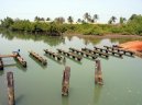
| Waterways | 1,000 km (primarily on Senegal, Saloum, and Casamance rivers) (2005) |
|
| Ports and terminals | Dakar |
|
| Military - Senegal: |
| Military branches | Army, Senegalese Navy (Marine Senegalaise), Senegalese Air Force (Armee de lAir du Senegal) (2007) |
|
| Military service age and obligation | 18 years of age for compulsory and voluntary military service; conscript service obligation - 2 years (2004) |
|
| Manpower available for military service | males age 18-49: 2,443,840
females age 18-49: 2,461,939 (2005 est.) |
|
| Manpower fit for military service | males age 18-49: 1,558,175
females age 18-49: 1,642,533 (2005 est.) |
|
| Manpower reaching military service age annually | males age 18-49: 129,331
females age 18-49: 129,398 (2005 est.) |
|
| Refugees and internally displaced persons | refugees (country of origin): 19,712 (Mauritania)
IDPs: 22,400 (approximately 65% of the IDP population returned in 2005, but new displacement is occurring due to clashes between government troops and separatists in Casamance region) (2006) |
|
| Military expenditures percent of gdp | 1.4% (2005 est.) |
|
| Disputes international | The Gambia and Guinea-Bissau attempt to stem separatist violence, cross border raids, and arms smuggling into their countries from Senegals Casamance region, and in 2006, respectively accepted 6,000 and 10,000 Casamance residents fleeing the conflict; 2,500 Guinea-Bissau residents fled into Senegal in 2006 to escape armed confrontations along the border |
|
This page was last updated on 16 September, 2007