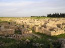
Cities of country: Syria ,region: Halab
A B C D E F G H I J K L M N O P Q R S T U V W X Y Z
founded: 409cities on M (region Halab: 4579, country Syria: 18139)| Name | Population | Altitude | Latitude | Longitude |
Minnik : |
|
| 36°31'31.1" N | 37°2'53.2" E |
Mir Al Husayn : |
| 390 m | 36°10'59.9" N | 37°17'60.0" E |
Mir El Housseine (Mîr El Housseďne) : |
| 390 m | 36°10'59.9" N | 37°17'60.0" E |
Mirkane (Mîrkâne) : |
| 559 m | 36°31'59.9" N | 36°43'0.1" E |
Mirkan : |
| 559 m | 36°31'59.9" N | 36°43'0.1" E |
Mir Khane (Mîr Khâne) : |
| 495 m | 36°36'0.0" N | 37°43'0.1" E |
Mir Khan : |
| 495 m | 36°36'0.0" N | 37°43'0.1" E |
Mirouane (Mirouâne) : |
| 515 m | 36°21'0.0" N | 38°27'0.0" E |
Mirwan : |
| 515 m | 36°21'0.0" N | 38°27'0.0" E |
Mirza Chahid (Mirza Chahîd) : |
| 473 m | 36°37'59.9" N | 37°43'59.9" E |
Mirza Shahid : |
| 473 m | 36°37'59.9" N | 37°43'59.9" E |
Mishku : |
| 413 m | 36°49'59.9" N | 38°7'0.1" E |
Mishrafat Al Buwayr : |
|
| 36°36'0.0" N | 37°52'0.1" E |
Mishrafat Tall Tutun : |
|
| 36°7'0.1" N | 37°57'0.0" E |
Mishrifah : |
|
| 36°6'0.0" N | 37°51'0.0" E |
Mishrifat Abu Jabbar : |
|
| 36°16'0.1" N | 37°38'60.0" E |
Mishrifat Al Buwayr : |
|
| 36°36'0.0" N | 37°52'0.1" E |
Mishrifat At Tutun : |
|
| 36°7'0.1" N | 37°57'0.0" E |
Miskane : |
| 498 m | 36°22'59.9" N | 37°6'0.0" E |
Misqane (Misqâne) : |
|
| 36°22'59.9" N | 37°6'0.0" E |
Misqan : |
| 498 m | 36°22'59.9" N | 37°6'0.0" E |
Missibine (Missibîne) : |
| 508 m | 36°28'59.9" N | 37°32'60.0" E |
Mitras : |
| 385 m | 36°37'59.9" N | 38°16'59.9" E |
Mizar Daoud (Mizar Dâoűd) : |
|
| 36°52'59.9" N | 38°21'0.0" E |
Mizghana : |
| 407 m | 36°30'0.0" N | 38°34'0.1" E |
Miznaz (Miznâz) : |
| 365 m | 36°2'60.0" N | 36°51'0.0" E |
Mizrana (Mizrâna) : |
| 407 m | 36°30'0.0" N | 38°34'0.1" E |
Mizrhana (Mizrhâna) : |
|
| 36°30'0.0" N | 38°34'0.1" E |
Mkeblis (Mkéblis) : |
|
| 36°13'59.9" N | 36°52'0.1" E |
Mlayhiyih : |
| 348 m | 36°1'59.9" N | 37°10'0.1" E |
Mlehiye (Mléhiyé) : |
|
| 36°1'59.9" N | 37°10'0.1" E |
Mleihiye (Mleďhîyé) : |
|
| 36°1'59.9" N | 37°10'0.1" E |
Mokhmar Boudjaq (Mokhmar Boűdjâq) : |
|
| 36°30'0.0" N | 38°15'0.0" E |
Molla Assaad : |
| 372 m | 36°37'0.1" N | 38°1'59.9" E |
Molla Yaaqoub : |
| 577 m | 36°40'0.1" N | 37°30'0.0" E |
Molla Yaqoub : |
|
| 36°40'0.1" N | 37°30'0.0" E |
Mouaileh (Mouaďleh) : |
| 345 m | 35°53'60.0" N | 37°34'0.1" E |
Mouflasse (Mouflassé) : |
| 340 m | 36°7'59.9" N | 37°28'59.9" E |
Mouflissa : |
|
| 36°7'59.9" N | 37°28'59.9" E |
Moufliss : |
| 362 m | 36°43'59.9" N | 37°58'59.9" E |
Mougbilet Hassane Arha (Mougbilet Hassane Ârha) : |
|
| 36°25'59.9" N | 38°1'0.1" E |
Mouhtaraq El Kebir (Mouhtaraq El Kébîr) : |
|
| 36°27'0.0" N | 37°53'60.0" E |
Mouhtaraq Kebir (Mouhtaraq Kébîr) : |
|
| 36°27'0.0" N | 37°53'60.0" E |
Mouhtaraq Serhir (Mouhtaraq Sérhir) : |
|
| 36°27'0.0" N | 37°53'60.0" E |
Moula Assaad (Moűla Assaad) : |
|
| 36°37'0.1" N | 38°1'59.9" E |
Moula Yaaqoub (Moula Yaaqoűb) : |
|
| 36°40'0.1" N | 37°30'0.0" E |
Moumane Aaza (Moumâne Aaza) : |
| 572 m | 36°52'0.1" N | 38°16'59.9" E |
Moumane Aazo (Moűmâne Aazo) : |
|
| 36°52'0.1" N | 38°16'59.9" E |
Mounbateh : |
| 271 m | 35°49'0.1" N | 37°13'59.9" E |
Mountar : |
| 532 m | 35°58'5.9" N | 37°15'32.0" E |
Mouqbile (Mouqbilé) : |
|
| 36°16'59.9" N | 37°17'60.0" E |
Mouqbilet Hassane Arha : |
|
| 36°25'59.9" N | 38°1'0.1" E |
Mourabbaat Biche (Mourabbaat Bîché) : |
| 393 m | 35°47'60.0" N | 37°22'59.9" E |
Mourabbaet Biche (Mourabbaet Bîché) : |
|
| 35°47'60.0" N | 37°22'59.9" E |
Mourabbaet Salloum (Mourabbaet Salloűm) : |
| 436 m | 35°46'59.9" N | 37°22'59.9" E |
Mouraibett (Mouraďbett) : |
| 320 m | 36°4'0.1" N | 38°4'59.9" E |
Mourchid Peunar (Mourchid Peunâr) : |
|
| 36°53'60.0" N | 38°16'59.9" E |
Mourdane (Moűrdâne) : |
| 508 m | 36°49'0.1" N | 38°22'59.9" E |
Mourhairate (Mourhaďrâte) : |
| 388 m | 36°34'59.9" N | 38°12'0.0" E |
Mourhartine (Mourhartîne) : |
|
| 36°31'59.9" N | 38°19'59.9" E |
Mouslimie (Mouslimié) : |
| 406 m | 36°19'0.1" N | 37°12'0.0" E |
Mouslimiye (Mouslimiyé) : |
|
| 36°19'0.1" N | 37°12'0.0" E |
Moussi Kanli : |
|
| 36°43'0.1" N | 36°38'60.0" E |
Moustariha : |
|
| 36°17'60.0" N | 37°43'59.9" E |
Mousteriha (Moustériha) : |
|
| 36°17'60.0" N | 37°43'59.9" E |
Moustraiha : |
|
| 36°17'60.0" N | 37°43'59.9" E |
Moutarek El Kbir : |
|
| 36°27'0.0" N | 37°53'60.0" E |
Moutarek Es Sghir : |
|
| 36°27'0.0" N | 37°53'60.0" E |
Moutqelta : |
| 327 m | 36°16'59.9" N | 38°7'59.9" E |
Mqoulbe (Mqoulbé) : |
|
| 36°16'59.9" N | 37°17'60.0" E |
Back, View continents ... |
Free IQ test online
An Intelligence Quotient or IQ is a score derived from one of several different standardized tests attempting to measure intelligence. Although the term "IQ" is still in common use, the scoring of modern IQ tests such as the Wechsler Adult Intelligence Scale is now based on a projection of the subject's measured rank on the Gaussian bell curve with a center value (average IQ) of 100, and a standard deviation of 15, although different tests may have different standard deviations. The average IQ scores for many populations have been rising at an average rate of three points per decade since the early 20th century with most of the increase in the lower half of the IQ range: a phenomenon called the Flynn effect. It is disputed whether these changes in scores reflect real changes in intellectual abilities, or merely methodological problems with past or present testing. (Wikipedie)
IQ test lasts approximately 30 minutes and contains 40 questions !
In the IQ test you must focus on the maximum. Test questions are simple. In the IQ test may not use the calculator and paper.
Free IQ test online :
Banner on your page · Visitor's book · Besplatnye igry onlajn · Free games online · CZ Hry · RoboStav
Copyright (c) 2024 by TiptopGlobe.com. All Rights Reserved!