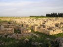
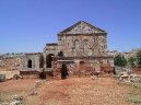
Cities of country: Syria ,region: Halab
A B C D E F G H I J K L M N O P Q R S T U V W X Y Z
founded: 539cities on K (region Halab: 4579, country Syria: 18139)| Name | Population | Altitude | Latitude | Longitude |
Kerid (Kérîd) : |
|
| 36°43'59.9" N | 38°13'59.9" E |
Keri : |
| 480 m | 36°37'59.9" N | 36°36'0.0" E |
Kerpitchelli : |
|
| 36°36'0.0" N | 37°43'59.9" E |
Kerpitchli : |
|
| 36°36'0.0" N | 37°43'59.9" E |
Kerpitchlli : |
|
| 36°36'0.0" N | 37°43'59.9" E |
Kerri : |
|
| 36°37'59.9" N | 36°36'0.0" E |
Kersane (Kersâne) : |
| 481 m | 36°31'59.9" N | 38°6'0.0" E |
Kersannli : |
| 533 m | 36°40'0.1" N | 37°31'59.9" E |
Kersenti : |
|
| 36°40'0.1" N | 37°31'59.9" E |
Keur Biehk : |
|
| 36°53'60.0" N | 38°13'59.9" E |
Keur Daouchane (Keur Daouchâne) : |
| 527 m | 36°19'59.9" N | 38°22'59.9" E |
Keur Heuyuk : |
| 501 m | 36°30'0.0" N | 37°37'59.9" E |
Keur Huyuk : |
|
| 36°30'0.0" N | 37°37'59.9" E |
Keur Peunar (Keur Peunâr) : |
|
| 36°49'0.1" N | 38°22'0.1" E |
Kfair (Kfaďr) : |
| 563 m | 36°22'0.1" N | 37°25'59.9" E |
Kfar Zeit (Kfar Zeďt) : |
|
| 36°25'0.1" N | 36°49'0.1" E |
Kfeir (Kfeďr) : |
|
| 36°22'0.1" N | 37°25'59.9" E |
Khachkhach Kebir (Khachkhâch Kébîr) : |
| 359 m | 36°23'60.0" N | 38°13'59.9" E |
Khachkhach Serhir (Khachkhâch Sérhîr) : |
| 315 m | 36°25'0.1" N | 38°13'0.1" E |
Khafar Yanli : |
| 712 m | 36°45'0.0" N | 36°46'59.9" E |
Khafar Yannli : |
| 712 m | 36°45'0.0" N | 36°46'59.9" E |
Khafiya : |
| 446 m | 36°27'0.0" N | 38°4'59.9" E |
Khafiyat Abu Qalqal : |
| 446 m | 36°27'0.0" N | 38°4'59.9" E |
Khafiyat Al Humr : |
| 418 m | 36°16'0.1" N | 37°57'0.0" E |
Khafiyet Abou Qalqal (Khâfîyet Abou Qalqal) : |
|
| 36°27'0.0" N | 38°4'59.9" E |
Khafiyet El Homr (Khafîyet El Homr) : |
|
| 36°16'0.1" N | 37°57'0.0" E |
Khaflyet El Homr : |
|
| 36°16'0.1" N | 37°57'0.0" E |
Khafre Kebire (Khafré Kébiré) : |
|
| 36°13'59.9" N | 38°1'0.1" E |
Khafsah As Saghirah : |
| 352 m | 36°13'0.1" N | 38°2'60.0" E |
Khafsah Kabir : |
|
| 36°13'59.9" N | 38°1'0.1" E |
Khafsah : |
| 372 m | 36°13'59.9" N | 37°58'59.9" E |
Khafsah Saghir : |
| 352 m | 36°13'0.1" N | 38°2'60.0" E |
Khafse El Kebire (Khafsé El Kébîré) : |
|
| 36°13'59.9" N | 38°1'0.1" E |
Khafse (Khafsé) : |
|
| 36°13'59.9" N | 38°1'0.1" E |
Khafse Serhire (Khafsé Sérhîré) : |
|
| 36°13'0.1" N | 38°2'60.0" E |
Khaibe (Khaďbé) : |
|
| 36°31'59.9" N | 37°25'0.1" E |
Khaissa (Khaďssa) : |
|
| 36°32'60.0" N | 37°40'0.1" E |
Khaled El Hidjane (Khaled El Hidjané) : |
| 508 m | 36°32'60.0" N | 37°46'59.9" E |
Khaled El Hijane (Khâled El Hijâne) : |
|
| 36°32'60.0" N | 37°46'59.9" E |
Khalepion : |
|
| 36°12'10.1" N | 37°9'31.0" E |
Khalfatli : |
| 499 m | 36°38'60.0" N | 37°19'0.1" E |
Khali`ah : |
|
| 36°32'60.0" N | 37°40'0.1" E |
Khalid Al Hayjan : |
| 508 m | 36°32'60.0" N | 37°46'59.9" E |
Khalid Al Hijanah : |
|
| 36°32'60.0" N | 37°46'59.9" E |
Khalid Al Hijan : |
|
| 36°32'60.0" N | 37°46'59.9" E |
Khalidjiq : |
| 428 m | 36°43'0.1" N | 38°12'0.0" E |
Khalil Orhlou (Khalîl Orhlou) : |
|
| 36°40'59.9" N | 37°32'60.0" E |
Khalisah : |
|
| 36°32'60.0" N | 37°40'0.1" E |
Khalissa : |
|
| 36°32'60.0" N | 37°40'0.1" E |
Khalisse (Khalissé) : |
|
| 36°32'60.0" N | 37°38'60.0" E |
Khalisse Serhire (Khalissé Sérhîre) : |
|
| 36°32'60.0" N | 37°38'60.0" E |
Khallawmar : |
| 620 m | 36°43'0.1" N | 38°19'59.9" E |
Khal Orhlou : |
| 583 m | 36°40'59.9" N | 37°32'60.0" E |
Khamassir : |
| 459 m | 35°46'59.9" N | 37°28'59.9" E |
Khanabcha Sghir : |
| 485 m | 36°19'59.9" N | 37°23'60.0" E |
Khan Al `asal : |
| 320 m | 36°10'0.1" N | 37°1'59.9" E |
Khan Al Humr : |
| 430 m | 36°17'60.0" N | 37°58'0.1" E |
Khan Ash Sha`r : |
| 336 m | 36°4'0.1" N | 37°58'59.9" E |
Khanasir : |
| 459 m | 35°46'59.9" N | 37°28'59.9" E |
Khanasser (Khanâsser) : |
|
| 35°46'59.9" N | 37°28'59.9" E |
Khanazir : |
| 368 m | 36°2'60.0" N | 37°58'59.9" E |
Khane Ech Chaar : |
| 336 m | 36°4'0.1" N | 37°58'59.9" E |
Khane Ech Chair (Khane Ech Chaďr) : |
|
| 36°4'0.1" N | 37°58'59.9" E |
Khane El Aassal (Khâne El Aassal) : |
| 320 m | 36°10'0.1" N | 37°1'59.9" E |
Khane El Assal : |
|
| 36°10'0.1" N | 37°1'59.9" E |
Khane El Homr (Khâne El Homr) : |
| 430 m | 36°17'60.0" N | 37°58'0.1" E |
Khane Habirat : |
| 520 m | 36°17'60.0" N | 37°19'59.9" E |
Khane Hafire (Khâne Hafîré) : |
|
| 36°17'60.0" N | 37°19'59.9" E |
Khan El Abrache : |
| 358 m | 36°1'0.1" N | 37°25'59.9" E |
Back, View continents ... |
Free IQ test online
An Intelligence Quotient or IQ is a score derived from one of several different standardized tests attempting to measure intelligence. Although the term "IQ" is still in common use, the scoring of modern IQ tests such as the Wechsler Adult Intelligence Scale is now based on a projection of the subject's measured rank on the Gaussian bell curve with a center value (average IQ) of 100, and a standard deviation of 15, although different tests may have different standard deviations. The average IQ scores for many populations have been rising at an average rate of three points per decade since the early 20th century with most of the increase in the lower half of the IQ range: a phenomenon called the Flynn effect. It is disputed whether these changes in scores reflect real changes in intellectual abilities, or merely methodological problems with past or present testing. (Wikipedie)
IQ test lasts approximately 30 minutes and contains 40 questions !
In the IQ test you must focus on the maximum. Test questions are simple. In the IQ test may not use the calculator and paper.
Free IQ test online :
Banner on your page · Visitor's book · Besplatnye igry onlajn · Free games online · CZ Hry · RoboStav
Copyright (c) 2024 by TiptopGlobe.com. All Rights Reserved!