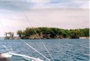
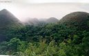
Cities of country: Philippines ,region: Leyte
A B C D E F G H I J K L M N O P Q R S T U V W X Y Z
founded: 77cities on S (region Leyte: 1380, country Philippines: 39685)| Name | Population | Altitude | Latitude | Longitude |
Saay : |
| 103 m | 11°7'0.1" N | 124°25'58.8" E |
Sabang : |
| 13 m | 10°43'59.9" N | 125°1'1.2" E |
Sabang Vito : |
| 29 m | 10°43'59.9" N | 125°1'1.2" E |
Sadyapun : |
| 100 m | 11°13'59.9" N | 124°43'58.8" E |
Sagkahan : |
| 25 m | 11°16'59.9" N | 124°43'1.2" E |
Salangi : |
| 31 m | 11°37'0.1" N | 124°22'58.8" E |
Saliri : |
| 31 m | 11°16'0.1" N | 124°43'58.8" E |
Salug : |
|
| 10°46'0.1" N | 124°58'58.8" E |
Salvacion : |
| 1 m | 11°13'0.1" N | 124°54'0.0" E |
Salvador : |
| 1 m | 11°7'0.1" N | 125°1'1.2" E |
Sambulawan : |
| 100 m | 11°20'60.0" N | 124°30'0.0" E |
Samputan : |
| 1 m | 11°25'10.9" N | 124°54'21.6" E |
San Agustin : |
| 63 m | 10°22'59.9" N | 124°45'0.0" E |
San Andres : |
| 40 m | 10°57'28.1" N | 124°56'9.6" E |
Sanang : |
| 11 m | 10°28'0.1" N | 124°43'58.8" E |
San Antonio (San Antonio) : | 2 325 | 6 m | 10°57'52.9" N | 124°38'49.2" E |
San Augustin : |
| 18 m | 10°47'8.2" N | 124°46'44.4" E |
San Benito : |
| 29 m | 11°2'55.0" N | 124°53'45.6" E |
Sancaling : |
| 18 m | 11°28'0.1" N | 124°28'58.8" E |
San Diego : |
| 26 m | 10°58'59.9" N | 124°54'0.0" E |
San Esteban : |
| 79 m | 10°57'18.0" N | 124°54'50.4" E |
San Francisco (San Francisco) : | 8 989 | 26 m | 10°58'0.1" N | 124°52'1.2" E |
Sangabon : |
| 1 m | 11°11'60.0" N | 124°22'58.8" E |
San Gabriel : |
| 36 m | 10°59'58.9" N | 124°55'48.0" E |
San Galang : |
| 76 m | 11°29'48.1" N | 124°29'9.6" E |
Sangputan : |
| 1 m | 11°25'10.9" N | 124°54'21.6" E |
San Ignacio : |
| 55 m | 11°0'0.0" N | 124°54'0.0" E |
San Isidro (San Isidro) : | 2 735 | 20 m | 10°58'0.1" N | 124°25'58.8" E |
San Joaquin : |
| 1 m | 11°8'48.8" N | 125°0'3.6" E |
San Jose (San Jose) : | 3 744 | 50 m | 10°59'20.0" N | 125°2'6.0" E |
San Juan : |
| 131 m | 10°16'16.0" N | 124°49'58.8" E |
San Mateo : |
| 14 m | 11°18'0.0" N | 124°42'0.0" E |
San Miguel (San Miguel) : | 3 401 | 19 m | 11°16'1.9" N | 124°49'55.2" E |
San Pablo : |
| 41 m | 10°58'59.9" N | 124°55'58.8" E |
San Pedro (San Pedro) : | 3 603 | 13 m | 10°57'41.0" N | 124°49'8.4" E |
San Roque (San Roque) : | 2 811 | 67 m | 11°0'34.9" N | 125°2'13.2" E |
Santa Ana : |
| 61 m | 10°55'32.9" N | 124°55'40.8" E |
Santa Cruz (Santa Cruz) : | 4 339 | 81 m | 10°22'59.9" N | 124°45'0.0" E |
Santa Elena : |
| 33 m | 10°54'0.0" N | 124°55'58.8" E |
Santa Fe (Santa Fe) : | 2 204 | 4 m | 10°14'15.0" N | 124°46'19.2" E |
Santa Margarita : |
| 63 m | 10°24'47.2" N | 124°49'22.8" E |
Santarin : |
| 4 m | 11°19'25.0" N | 124°43'44.4" E |
Santa Rosa : |
| 10 m | 11°5'39.1" N | 124°25'12.0" E |
Santiago (Santiago) : | 2 338 | 42 m | 11°4'0.1" N | 124°25'58.8" E |
Santol : |
| 24 m | 11°14'53.2" N | 124°47'31.2" E |
Santo Nino (Santo Nińo) : | 2 012 | 36 m | 10°55'43.0" N | 124°57'32.4" E |
Santo : |
| 68 m | 11°12'38.9" N | 124°56'52.8" E |
San Vicente (San Vicente) : | 2 081 | 39 m | 11°1'23.9" N | 124°59'42.0" E |
San Victoray : |
| 74 m | 10°55'0.1" N | 124°55'58.8" E |
San Victor : |
| 74 m | 10°55'0.1" N | 124°55'58.8" E |
San Vincente : |
| 37 m | 11°12'31.0" N | 124°48'36.0" E |
Sapa : |
| 334 m | 10°35'60.0" N | 124°49'58.8" E |
Sarisari : |
| 96 m | 11°8'21.8" N | 124°48'46.8" E |
Seguinon (Seguinon) : |
| 5 m | 10°56'28.0" N | 124°41'9.6" E |
Siguinon (Siguinon) : | 2 211 | 5 m | 10°56'28.0" N | 124°41'9.6" E |
Silad : |
| 26 m | 11°13'23.9" N | 124°23'52.8" E |
Sinalgan : |
| 21 m | 11°3'0.0" N | 124°55'1.2" E |
Sinayawan : |
| 336 m | 11°16'0.1" N | 124°35'60.0" E |
Sirab : |
| 26 m | 11°4'0.1" N | 124°52'58.8" E |
Siyabo : |
| 4 m | 10°40'59.9" N | 124°47'60.0" E |
Sogod (Sogod) : | 2 968 | 42 m | 10°54'0.0" N | 124°27'0.0" E |
Soledad : |
| 49 m | 11°13'0.8" N | 124°46'19.2" E |
Solegad : |
| 49 m | 11°13'0.8" N | 124°46'19.2" E |
Songon : |
| 98 m | 10°19'59.9" N | 124°52'1.2" E |
Sonlagon : |
| 83 m | 11°16'59.9" N | 124°24'0.0" E |
Subancogon : |
| 22 m | 11°31'23.2" N | 124°21'25.2" E |
Suba : |
| 63 m | 11°4'59.9" N | 124°24'0.0" E |
Sucre : |
| 39 m | 10°40'0.1" N | 124°50'60.0" E |
Sudlon : |
| 174 m | 11°22'18.1" N | 124°31'1.2" E |
Sugbancogan : |
| 22 m | 11°31'23.2" N | 124°21'25.2" E |
Sugboncogon : |
|
| 11°31'23.2" N | 124°21'25.2" E |
Sugud : |
| 36 m | 11°16'0.1" N | 124°40'58.8" E |
Back, View continents ... |
Free IQ test online
An Intelligence Quotient or IQ is a score derived from one of several different standardized tests attempting to measure intelligence. Although the term "IQ" is still in common use, the scoring of modern IQ tests such as the Wechsler Adult Intelligence Scale is now based on a projection of the subject's measured rank on the Gaussian bell curve with a center value (average IQ) of 100, and a standard deviation of 15, although different tests may have different standard deviations. The average IQ scores for many populations have been rising at an average rate of three points per decade since the early 20th century with most of the increase in the lower half of the IQ range: a phenomenon called the Flynn effect. It is disputed whether these changes in scores reflect real changes in intellectual abilities, or merely methodological problems with past or present testing. (Wikipedie)
IQ test lasts approximately 30 minutes and contains 40 questions !
In the IQ test you must focus on the maximum. Test questions are simple. In the IQ test may not use the calculator and paper.
Free IQ test online :
Banner on your page · Visitor's book · Besplatnye igry onlajn · Free games online · CZ Hry · RoboStav
Copyright (c) 2026 by TiptopGlobe.com. All Rights Reserved!